Turtle 2038: Comprehensive Plan for Turtle Creek was a final deliverable of a land use planning project for a hypothecal city. Based on the basic city GIS datasets, we proposed this comprehensive plan in terms of developing areawide land use policy, community-wide land policy, and subarea plan.
This project has been developed to help guide the future of Turtle Creek through the use of a set of public policies and successful community involvement. The Plan is intended to be a navigation chart that will guide city government officials as well as business owners, landowners, and residents of Turtle Creek to keep our city a safe and livable place. It has been a long and complicated process, but because of our strong sense of community and determination, I am confident we will overcome the obstacles that are ahead of us together with the action plan proposed by this Comprehensive Plan.
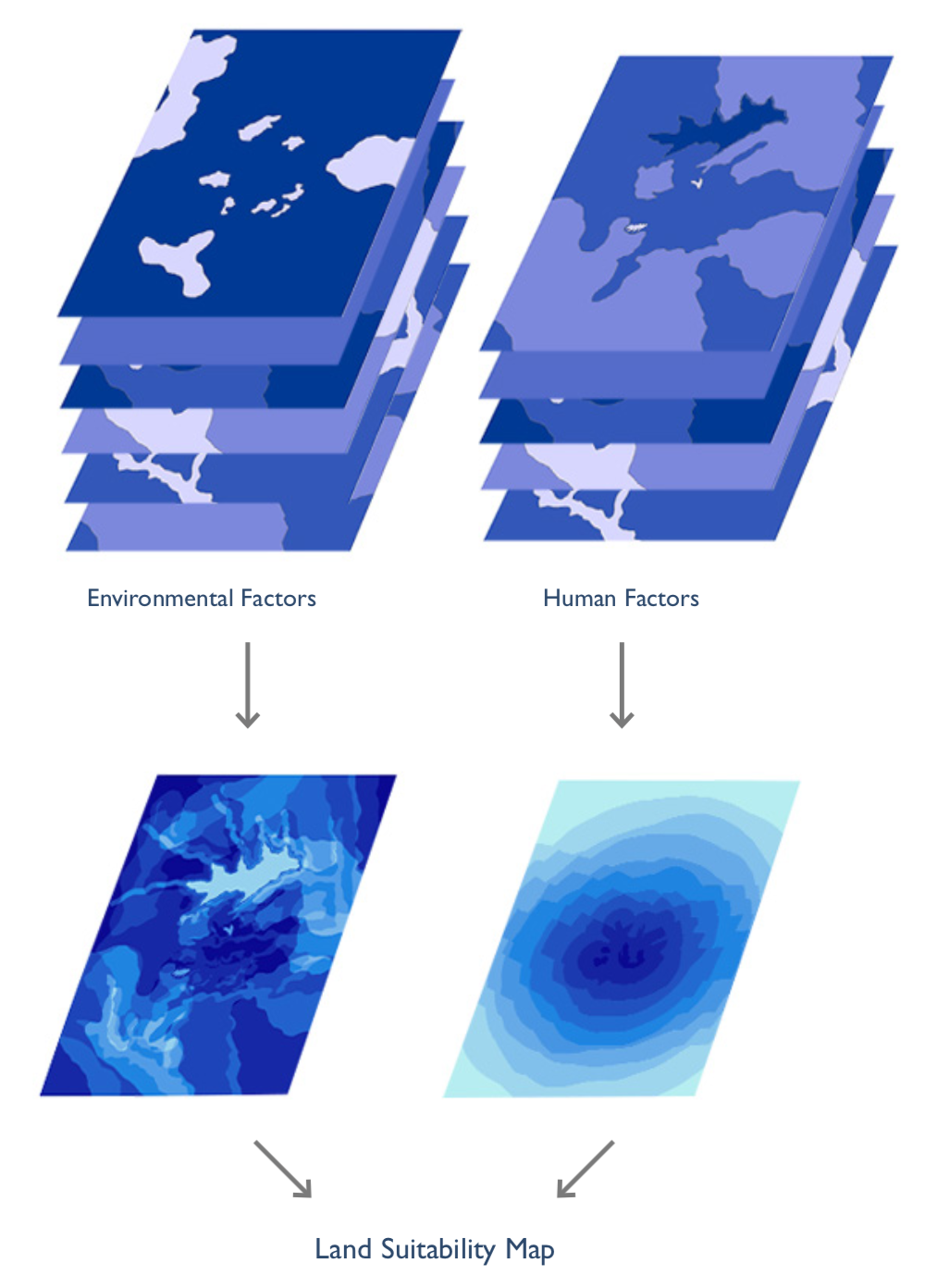
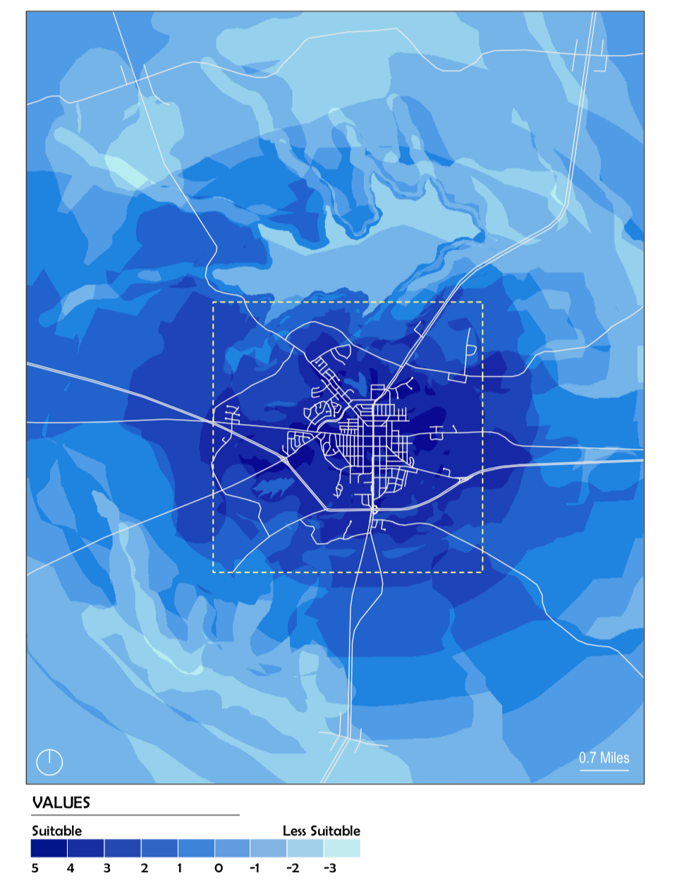
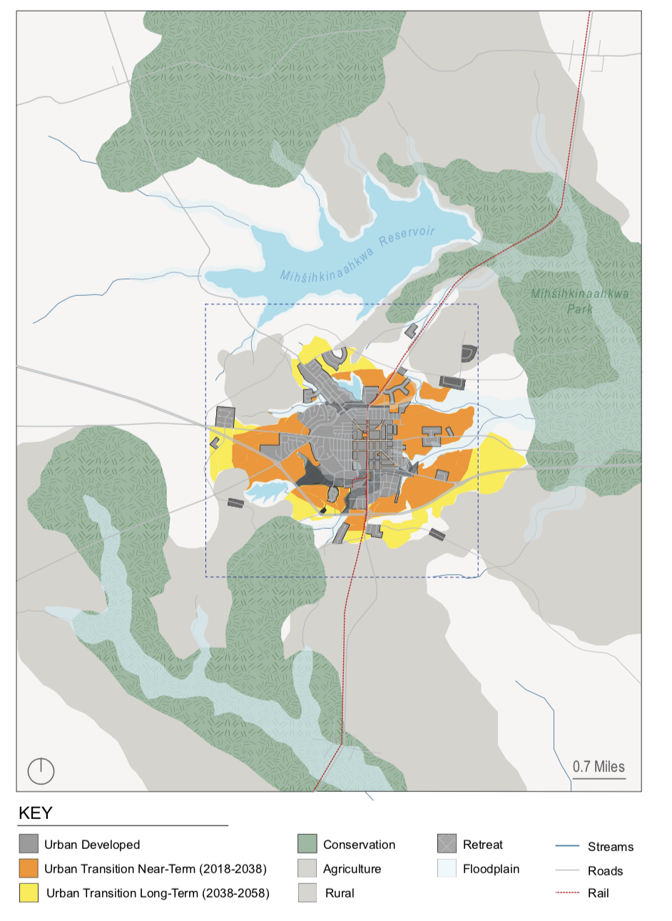
My role in this research project was a senior data analyst. During this four-month project, I participated in the whole development process of this land use plan. In particular, I was in charge of map creation, spatial analysis, and land use classficiation. Below are some of my deliverables.